
Burni Telong topographic map
Interactive map
Click on the map to display elevation.
About this map
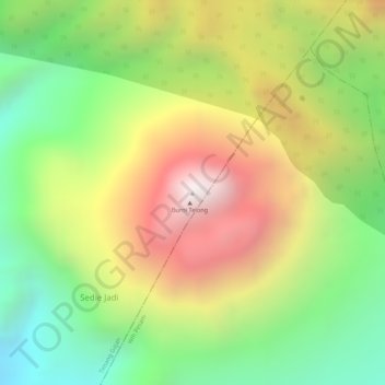
Name: Burni Telong topographic map, elevation, terrain.
Location: Burni Telong, Timang Gajah, Bener Meriah, Aceh, Indonesien (4.76965 96.82115 4.76975 96.82125)
Average elevation: 2,032 m
Minimum elevation: 1,537 m
Maximum elevation: 2,569 m
Other topographic maps
Click on a map to view its topography, its elevation and its terrain.