
Noshaq topographic map
Interactive map
Click on the map to display elevation.
About this map
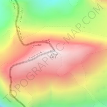
Name: Noshaq topographic map, elevation, terrain.
Location: Noshaq, Chitrāl District, Khyber Pakhtunkhwa, Pakistan (36.43494 71.83841 36.43504 71.83851)
Average elevation: 6,856 m
Minimum elevation: 6,018 m
Maximum elevation: 7,465 m
Other topographic maps
Click on a map to view its topography, its elevation and its terrain.
Saro Kaly
Pakistan > Khyber Pakhtunkhwa > Saro Kaly
Saro Kaly, Khyber Pakhtunkhwa, Pakistan
Average elevation: 348 m
Swat
Pakistan > Khyber Pakhtunkhwa > Abazai > Gul Bagh
Swat, Gul Bagh, Abazai, Khyber Pakhtunkhwa, Pakistan
Average elevation: 370 m
Sirikot
Pakistan > Khyber Pakhtunkhwa > Sirikot
Sirikot, Khyber Pakhtunkhwa, 22840, Pakistan
Average elevation: 882 m
Former Chitrāl District
Former Chitrāl District, Khyber Pakhtunkhwa, Pakistan
Average elevation: 3,729 m
Abbottabad
Pakistan > Khyber Pakhtunkhwa > Abbottabad
Abbottabad, Khyber Pakhtunkhwa, 22010, Pakistan
Average elevation: 1,365 m
Koyo Zom
Koyo Zom, Chitrāl District, Khyber Pakhtunkhwa, Pakistan
Average elevation: 5,925 m
Malakand
Pakistan > Khyber Pakhtunkhwa > Malakand
Malakand, Mardān District, Khyber Pakhtunkhwa, Pakistan
Average elevation: 787 m
Peshāwar District
Peshāwar District, Khyber Pakhtunkhwa, Pakistan
Average elevation: 684 m
Saraghrar I
Saraghrar I, Chitrāl District, Khyber Pakhtunkhwa, Pakistan
Average elevation: 6,780 m
Buni Zom
Buni Zom, Chitrāl District, Khyber Pakhtunkhwa, Pakistan
Average elevation: 5,627 m
Istor-o-Nal
Istor-o-Nal, Chitrāl District, Khyber Pakhtunkhwa, Pakistan
Average elevation: 6,853 m
Chitral
Pakistan > Khyber Pakhtunkhwa > Chitrāl District
Chitral, Chitral Tehsil, Lower Chitral District, Chitrāl District, Malakand Division, Khyber Pakhtunkhwa, Pakistan
Average elevation: 2,982 m
Khyber Agency
Khyber Agency, Peshawar Division, Khyber Pakhtunkhwa, Pakistan
Average elevation: 1,063 m
Khyber Pakhtunkhwa
Khyber Pakhtunkhwa, Pakistan
Average elevation: 2,135 m