Geolocate

Okotoks topographic map

Click on the map to display elevation.

About this map

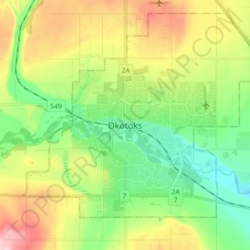
Name: Okotoks topographic map, elevation, terrain.

Location: Okotoks, Town of Okotoks, Alberta, T1S 2N7, Canada (50.68537 -114.01508 50.76537 -113.93508)

Average elevation: 1,096 m

Minimum elevation: 1,026 m

Maximum elevation: 1,209 m

Town of Okotoks trails, hiking, mountain biking, running and outdoor activities

Gear up for your next adventure:

🧥Softshell Hiking Jacket - The perfect balance of wind protection and breathability
🎒Fully Waterproof Backpack - Total protection for photography gear and electronics
🥾Approach Shoes - Shoes designed for climbing approaches and rugged trails
🐕Hiking Dog Pack - Let your canine companion carry their own water and food
🧭GPS Tracker - Track your location in remote areas safely

As an Amazon Associate, this site earns from qualifying purchases at no extra cost to you.