Geolocate

Fernandina Beach topographic map

Click on the map to display elevation.

About this map
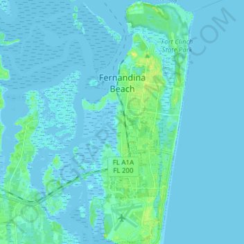
Name: Fernandina Beach topographic map, elevation, terrain.

Location: Fernandina Beach, Nassau County, Florida, United States (30.59886 -81.47726 30.70583 -81.42636)

Average elevation: 2 m

Minimum elevation: -4 m

Maximum elevation: 17 m

Gear up for your next adventure:

💡Compact LED Flashlight - Powerful and portable flashlight for outdoor use
🧼Biodegradable Camp Soap - Environmentally friendly cleaning for gear and body
🧭Orienteering Kit - Tools for map reading and navigation in the wild
🧥Packable Rain Jacket - Breathable waterproof layer for unpredictable weather
🥾Light Hiking Boots - Lightweight and comfortable boots for day hikes

As an Amazon Associate, this site earns from qualifying purchases at no extra cost to you.