Geolocate

Alblasserdam topographic map

Click on the map to display elevation.

About this map

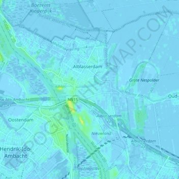
Name: Alblasserdam topographic map, elevation, terrain.

Location: Alblasserdam, South Holland, Netherlands (51.83865 4.62639 51.88121 4.70024)

Average elevation: 1 m

Minimum elevation: -4 m

Maximum elevation: 14 m

Gear up for your next adventure:

🪑Insulated Seat Pad - Protect your seat from cold rocks and wet logs
💧Hydration Bladder - Hands-free hydration solution for long treks
🥾Waterproof Trail Shoes - Shoes designed to handle wet terrain
Lightweight Backpacking Tent - Compact tent for efficient hiking trips
🥾Trail Running Shoes - Lightweight and durable shoes for trail running

As an Amazon Associate, this site earns from qualifying purchases at no extra cost to you.