Geolocate

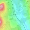
Ribblesdale topographic map

Click on the map to display elevation.

About this map

Name: Ribblesdale topographic map, elevation, terrain.

Location: Ribblesdale, Horton in Ribblesdale, North Yorkshire, York and North Yorkshire, England, United Kingdom (54.05716 -2.34636 54.24623 -2.27594)

Average elevation: 368 m

Minimum elevation: 110 m

Maximum elevation: 732 m

Other topographic maps

Click on a map to view its topography, its elevation and its terrain.
Gear up for your next adventure:

🩹Compact First Aid Kit - Pre-packed essentials for common trail injuries
🧢Hiking Hat - Sun-protective and breathable hats for long treks
🧴Bear Spray Holster - Quick-access carry for essential Canadian wilderness safety
👟Trail Running Shoes - Agile footwear for fast-paced topographic exploration
🧭GPS Tracker - Track your location in remote areas safely

As an Amazon Associate, this site earns from qualifying purchases at no extra cost to you.