Geolocate

Temple Sowerby topographic map

Click on the map to display elevation.

About this map

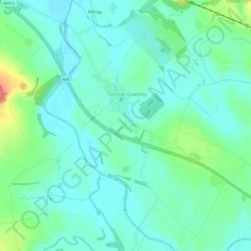
Name: Temple Sowerby topographic map, elevation, terrain.

Location: Temple Sowerby, Cumbria, England, United Kingdom (54.61860 -2.61982 54.65026 -2.57434)

Average elevation: 112 m

Minimum elevation: 93 m

Maximum elevation: 174 m

Gear up for your next adventure:

🛶Kayak Accessories - Essential gear for safe and fun kayaking adventures
🧣Evaporative Cooling Towel - Beat the heat during intense summer climbs
🥾Trail Hiking Boots - Supportive boots for rough trails
🛌Down Sleeping Bag - Superior warmth-to-weight ratio for cold nights
Lightweight Camping Tent - Portable shelter optimized for Canadian backcountry camping

As an Amazon Associate, this site earns from qualifying purchases at no extra cost to you.