Geolocate

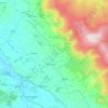
Kirkland topographic map

Click on the map to display elevation.

About this map

Name: Kirkland topographic map, elevation, terrain.

Location: Kirkland, Culgaith, Blencarn, Westmorland and Furness, England, CA10 1RN, United Kingdom (54.66685 -2.56750 54.70685 -2.52750)

Average elevation: 260 m

Minimum elevation: 148 m

Maximum elevation: 670 m

Other topographic maps

Click on a map to view its topography, its elevation and its terrain.
Gear up for your next adventure:

👟Sport Hiking Sandals - Breathable footwear for water crossings and camp rest
🧣Merino Neck Gaiter - Protects against wind, sun, and cold at high altitudes
🧢Hiking Sun Hat - Wide-brimmed protection for exposed mountain ridges
💧Reusable Water Bottle - Durable water bottles for hydration on trails
🥾Hiking Leggings - Comfortable leggings for outdoor activities

As an Amazon Associate, this site earns from qualifying purchases at no extra cost to you.