
Thank you for supporting this site ❤️
Make a donation
Make a donation
Gear up for your next adventure:
As an Amazon Associate, this site earns from qualifying purchases at no extra cost to you.
Chacpar topographic map
Click on the map to display elevation.
Thank you for supporting this site ❤️
Make a donation
Make a donation
Gear up for your next adventure:
As an Amazon Associate, this site earns from qualifying purchases at no extra cost to you.
About this map
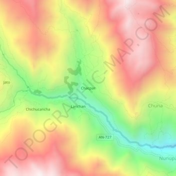
Name: Chacpar topographic map, elevation, terrain.
Location: Chacpar, Chavín de Huantar, Province of Huari, Ancash, Peru (-9.59676 -77.23408 -9.55676 -77.19408)
Average elevation: 3,907 m
Minimum elevation: 3,296 m
Maximum elevation: 4,409 m
Thank you for supporting this site ❤️
Make a donation
Make a donation
Gear up for your next adventure:
As an Amazon Associate, this site earns from qualifying purchases at no extra cost to you.