Geolocate

Chacpar topographic map

Click on the map to display elevation.

About this map

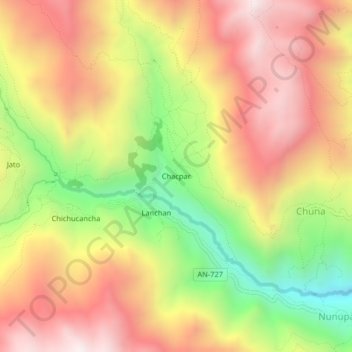
Name: Chacpar topographic map, elevation, terrain.

Location: Chacpar, Chavín de Huantar, Province of Huari, Ancash, Peru (-9.59676 -77.23408 -9.55676 -77.19408)

Average elevation: 3,907 m

Minimum elevation: 3,296 m

Maximum elevation: 4,409 m

Gear up for your next adventure:

❄️Traction Ice Cleats - Slip-on spikes for icy trails and winter hiking
🧤Insulated Winter Gloves - Heavy-duty protection for sub-zero Canadian adventures
🧦Thermal Socks - Warm socks for winter hiking or camping
🥾Trail Running Boots - Durable shoes designed for trail running
🛶Canoe Life Vest - Safety vest for water sports

As an Amazon Associate, this site earns from qualifying purchases at no extra cost to you.