Geolocate

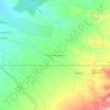
Corrales topographic map

Click on the map to display elevation.

About this map

Name: Corrales topographic map, elevation, terrain.

Location: Corrales, Sandoval County, New Mexico, 87048, United States (35.19771 -106.65735 35.28096 -106.58693)

Average elevation: 1,557 m

Minimum elevation: 1,522 m

Maximum elevation: 1,666 m

Other topographic maps

Click on a map to view its topography, its elevation and its terrain.
Placitas

United States > New Mexico > Sandoval County

Average elevation: 1,864 m

Anasazi Trails

United States > New Mexico > Sandoval County

Average elevation: 1,620 m

Seven Springs

United States > New Mexico > Sandoval County

Average elevation: 2,538 m

Palomas Peak

United States > New Mexico > Sandoval County

Average elevation: 2,423 m

Rio Puerco

United States > New Mexico > Sandoval County

Average elevation: 1,912 m

Placitas

United States > New Mexico > Sandoval County

Average elevation: 1,864 m

Valles Caldera

United States > New Mexico > Sandoval County

On July 25, 2025, the Valles Caldera National Preserve opened their new Volcano Discovery Center. Superintendent Jorge Silva-Bañuelos cut the opening ribbon. Visitors can interact with a 12-foot topographic relief map at the center of an exhibit designed by local New Mexico company, Ideum. Guests can also…

Average elevation: 2,899 m
La Cueva

United States > New Mexico > Sandoval County

Average elevation: 2,470 m

Cabezon

United States > New Mexico > Sandoval County

Average elevation: 1,888 m

Redondo Peak

United States > New Mexico > Sandoval County

Average elevation: 3,193 m

San Luis

United States > New Mexico > Sandoval County

Average elevation: 1,919 m

Gear up for your next adventure:

📷Outdoor Action Camera - Capture high-elevation views and rugged adventures
🍽️Titanium Camping Spork - Ultralight and indestructible eating utensil
🧤Insulated Winter Gloves - Heavy-duty protection for sub-zero Canadian adventures
🥾Trail Running Shoes - Lightweight and durable shoes for trail running
🧭Orienteering Kit - Tools for map reading and navigation in the wild

As an Amazon Associate, this site earns from qualifying purchases at no extra cost to you.