
Make a donation
Gear up for your next adventure:
As an Amazon Associate, this site earns from qualifying purchases at no extra cost to you.
Cerro Gigante topographic map
Click on the map to display elevation.
Make a donation
Gear up for your next adventure:
As an Amazon Associate, this site earns from qualifying purchases at no extra cost to you.
About this map
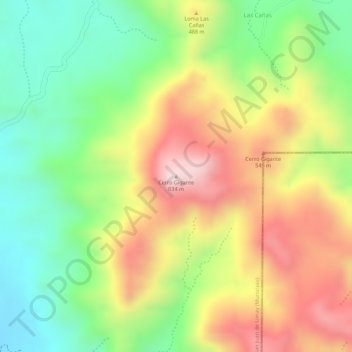
Name: Cerro Gigante topographic map, elevation, terrain.
Average elevation: 420 m
Minimum elevation: 222 m
Maximum elevation: 636 m
Make a donation
Gear up for your next adventure:
As an Amazon Associate, this site earns from qualifying purchases at no extra cost to you.
Other topographic maps
Click on a map to view its topography, its elevation and its terrain.
Esteli
Located on the Pan-American Highway, 150 km north of Managua, Estelí is a fast-growing and progressive city. It enjoys a pleasant climate most of the year due to its location in the north central highlands at a mean elevation of 844 m (2769 ft) above sea level. The city is also surrounded by forested…
Average elevation: 958 m
Condega (Municipio)
Condega (Spanish pronunciation: [konˈdeɣa]) is a municipality in the Estelí department of Nicaragua. It was officially incorporated on June 9, 1962. Condega is situated on the Pan-American Highway (Route One) at a distance of 185 kilometers north of Managua, and at an altitude of 560 meters (1,837 feet)…
Average elevation: 836 m
Make a donation
Gear up for your next adventure:
As an Amazon Associate, this site earns from qualifying purchases at no extra cost to you.