Geolocate

Henlade topographic map

Click on the map to display elevation.

About this map

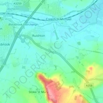
Name: Henlade topographic map, elevation, terrain.

Location: Henlade, Ruishton, Somerset, England, TA3 5HY, United Kingdom (50.99136 -3.06226 51.03136 -3.02226)

Average elevation: 25 m

Minimum elevation: 5 m

Maximum elevation: 100 m

Gear up for your next adventure:

Bushcraft Tarp - Versatile emergency shelter or gear protection
🧶550 Survival Paracord - Versatile utility cord for emergency repairs and rigging
Camping Groundsheet - Protect your tent from moisture and dirt
🧥Thermal Fleece Jacket - Versatile insulation for changing mountain temperatures
🧊Portable Cooler - Keep food and drinks cold during outdoor adventures

As an Amazon Associate, this site earns from qualifying purchases at no extra cost to you.