Geolocate

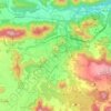
Olot topographic map

Click on the map to display elevation.

About this map
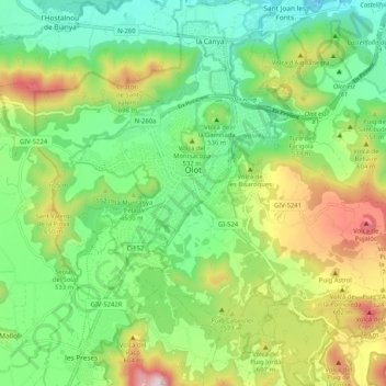
Name: Olot topographic map, elevation, terrain.

Location: Olot, Garrotxa, Girona, Catalonia, Spain (42.14974 2.44638 42.20532 2.54909)

Average elevation: 499 m

Minimum elevation: 293 m

Maximum elevation: 881 m

Other topographic maps

Click on a map to view its topography, its elevation and its terrain.

Llongarriu

Spain > Catalonia > Garrotxa > la Vall de Bianya

Average elevation: 698 m

Olot

Spain > Catalonia > Garrotxa > Olot > Olot

Average elevation: 489 m

Serrat dels Boixos

Spain > Catalonia > Garrotxa > Montagut i Oix > Oix

Average elevation: 687 m

Besalú

Spain > Catalonia > Garrotxa > Besalú > Besalú

Average elevation: 225 m

Pallerols

Spain > Catalonia > Garrotxa > Sant Feliu de Pallerols

Average elevation: 608 m

Gear up for your next adventure:

🔦UV Flashlight - Detect minerals or specific insects in the dark
🥾Lightweight Hiking Boots - Boots for comfort and mobility on long hikes
🥫Freeze-Dried Meals - Lightweight, high-calorie nutrition for multi-day treks
🌬️Windproof Camp Stove - Efficient cooking even on exposed mountain peaks
🥾Hiking Gaiters - Protect legs and shoes from mud, snow, and debris

As an Amazon Associate, this site earns from qualifying purchases at no extra cost to you.