
Lickton topographic map
Click on the map to display elevation.
About this map
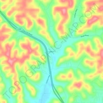
Name: Lickton topographic map, elevation, terrain.
Average elevation: 201 m
Minimum elevation: 147 m
Maximum elevation: 262 m
Other topographic maps
Click on a map to view its topography, its elevation and its terrain.
Edwin Warner Park
United States > Tennessee > Davidson County > Nashville > Devonshire Manor
Average elevation: 198 m
Harpeth River Greenway
United States > Tennessee > Davidson County > Nashville > Harpeth River Estates
Average elevation: 182 m
Ellington Agricultural Center
United States > Tennessee > Davidson County > Nashville
Average elevation: 178 m
Tennessee State Capitol
United States > Tennessee > Davidson County > Nashville
Average elevation: 139 m