Geolocate

Mittelberg topographic map

Click on the map to display elevation.

About this map
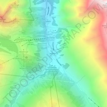
Name: Mittelberg topographic map, elevation, terrain.

Location: Mittelberg, Sankt Leonhard im Pitztal, Bezirk Imst, Tyrol, Austria (46.94271 10.85233 46.98271 10.89233)

Average elevation: 2,200 m

Minimum elevation: 1,617 m

Maximum elevation: 3,300 m

Other topographic maps

Click on a map to view its topography, its elevation and its terrain.

Pitztal

Austria > Tyrol > Bezirk Imst > Sankt Leonhard im Pitztal

Average elevation: 2,005 m

Gear up for your next adventure:

🧰Survival Kit - Essential gear for emergencies in the wilderness
🥾Hiking Boots - Sturdy boots providing ankle support and traction on rugged trails
🧤Thermal Hiking Gloves - Grip-enhanced gloves for cold-weather altitude trekking
🥾Trail Hiking Shoes - Durable shoes designed for rugged trails
💡LED Headlamp - Hands-free illumination for night hiking and camping

As an Amazon Associate, this site earns from qualifying purchases at no extra cost to you.