Geolocate

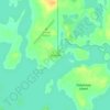
Slanted Rock Rapids topographic map

Click on the map to display elevation.

About this map

Name: Slanted Rock Rapids topographic map, elevation, terrain.

Location: Slanted Rock Rapids, Unorganized Division No. 23, Manitoba, Canada (55.65438 -93.55650 55.65525 -93.55490)

Average elevation: 144 m

Minimum elevation: 103 m

Maximum elevation: 160 m

Unorganized Division No. 23 trails, hiking, mountain biking, running and outdoor activities

Other topographic maps

Click on a map to view its topography, its elevation and its terrain.
Brochet

Canada > Manitoba > Unorganized Division No. 23

Average elevation: 340 m

Herchmer

Canada > Manitoba > Unorganized Division No. 23

Average elevation: 107 m

Gear up for your next adventure:

🚑Survival Whistle - Signal for help across long distances in mountains
⛺Backpacking Tent - Lightweight tent for long-distance hiking trips
🥾Mountaineering Boots - Supportive boots for climbing and high-altitude hiking
🥾Lightweight Hiking Shoes - Comfortable shoes for day hikes
🦯Trekking Poles - Reduced impact on joints for steep topographic climbs

As an Amazon Associate, this site earns from qualifying purchases at no extra cost to you.