

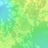
Herchmer topographic map
Click on the map to display elevation.
About this map

Name: Herchmer topographic map, elevation, terrain.
Location: Herchmer, Unorganized Division No. 23, Manitoba, Canada (57.36130 -94.19688 57.38130 -94.17688)
Average elevation: 107 m
Minimum elevation: 98 m
Maximum elevation: 112 m
Other topographic maps
Click on a map to view its topography, its elevation and its terrain.


Barren Lands First Nation
Canada > Manitoba > Unorganized Division No. 23 > Brochet
Average elevation: 359 m