Geolocate

Santa Clemencia topographic map

Click on the map to display elevation.

About this map

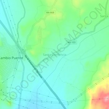
Name: Santa Clemencia topographic map, elevation, terrain.

Location: Santa Clemencia, Chimbote, Province of Santa, Ancash, Peru (-9.01677 -78.55881 -8.97677 -78.51881)

Average elevation: 91 m

Minimum elevation: 55 m

Maximum elevation: 196 m

Gear up for your next adventure:

🛰️Satellite Messenger - Emergency communication for areas with no cell service
🥾Mountain Hiking Shoes - Shoes with superior grip for mountainous terrain
🧣Merino Neck Gaiter - Protects against wind, sun, and cold at high altitudes
🧥Softshell Hiking Jacket - The perfect balance of wind protection and breathability
🥾Lightweight Hiking Boots - Boots for comfort and mobility on long hikes

As an Amazon Associate, this site earns from qualifying purchases at no extra cost to you.