Geolocate

Sherwin topographic map

Click on the map to display elevation.

About this map

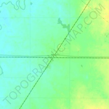
Name: Sherwin topographic map, elevation, terrain.

Location: Sherwin, Cherokee County, Kansas, United States (37.16006 -94.96774 37.20006 -94.92774)

Average elevation: 260 m

Minimum elevation: 251 m

Maximum elevation: 273 m

Other topographic maps

Click on a map to view its topography, its elevation and its terrain.

Weir

United States > Kansas > Cherokee County

Average elevation: 281 m

Columbus

United States > Kansas > Cherokee County

Average elevation: 275 m

Roseland

United States > Kansas > Cherokee County

Average elevation: 278 m

Weir

United States > Kansas > Cherokee County

Average elevation: 281 m

Gear up for your next adventure:

🚲MTB Frame Bag - Carry tools and maps directly on your bicycle frame
🧤Insulated Winter Gloves - Heavy-duty protection for sub-zero Canadian adventures
🥾Hiking Leggings - Comfortable leggings for outdoor activities
🥾Hiking Shoes - Durable and comfortable shoes for trail hiking
🪑Ultralight Camping Stool - Compact seating for rest stops during long hikes

As an Amazon Associate, this site earns from qualifying purchases at no extra cost to you.