Geolocate

Nieuwkoop topographic map

Click on the map to display elevation.

About this map

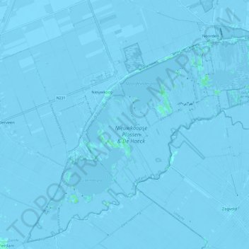
Name: Nieuwkoop topographic map, elevation, terrain.

Location: Nieuwkoop, South Holland, Netherlands (52.10648 4.73886 52.17477 4.85566)

Average elevation: -3 m

Minimum elevation: -9 m

Maximum elevation: 4 m

Other topographic maps

Click on a map to view its topography, its elevation and its terrain.

Meije

Netherlands > South Holland > Nieuwkoop

Average elevation: -2 m

Gear up for your next adventure:

Camping Tent - Weather-resistant tents suitable for 2 to 6 people
Bushcraft Tarp - Versatile emergency shelter or gear protection
🥾Hiking Leggings - Comfortable leggings for outdoor activities
Family Camping Tent - Spacious tent suitable for family camping trips
🧦Crew Hiking Socks - Comfortable socks for long-distance hikes

As an Amazon Associate, this site earns from qualifying purchases at no extra cost to you.