Geolocate

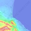
Chechen Island topographic map

Click on the map to display elevation.

About this map

Name: Chechen Island topographic map, elevation, terrain.

Location: Chechen Island, Makhachkala Urban Okrug, Dagestan, North Caucasian Federal District, Russia (43.93528 47.63466 44.00070 47.80517)

Average elevation: -27 m

Minimum elevation: -29 m

Maximum elevation: -20 m

Other topographic maps

Click on a map to view its topography, its elevation and its terrain.
Tarki

Russia > Dagestan > Makhachkala Urban Okrug

Average elevation: 136 m

Makhachkala

Russia > Dagestan > Makhachkala Urban Okrug

Average elevation: 57 m

Makhachkala

Russia > Dagestan > Makhachkala Urban Okrug

Average elevation: 57 m

Makhachkala

Russia > Dagestan > Makhachkala Urban Okrug

Average elevation: 57 m

Shamkhal

Russia > Dagestan > Makhachkala Urban Okrug

Average elevation: -3 m

Makhachkala

Russia > Dagestan > Makhachkala Urban Okrug

Average elevation: 57 m

Makhachkala

Russia > Dagestan > Makhachkala Urban Okrug

Average elevation: 57 m

Gear up for your next adventure:

🥾Light Trekking Boots - Supportive boots for multi-day treks
☕Camping Coffee Maker - Brew fresh coffee anywhere on the topographic map
🧥Ultralight Puffy Jacket - Maximum warmth that packs down to the size of an orange
⛺Camping Essentials - All-in-one gear for a comfortable camping trip
🥾Lightweight Hiking Shoes - Comfortable shoes for day hikes

As an Amazon Associate, this site earns from qualifying purchases at no extra cost to you.