Geolocate

Cedrillas topographic map

Click on the map to display elevation.

About this map

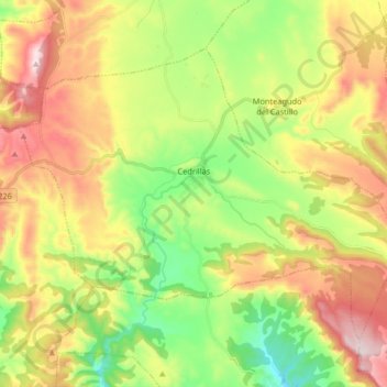
Name: Cedrillas topographic map, elevation, terrain.

Location: Cedrillas, Comunidad de Teruel, Teruel, Aragon, Spain (40.38176 -0.92666 40.47570 -0.76311)

Average elevation: 1,449 m

Minimum elevation: 1,215 m

Maximum elevation: 1,752 m

Gear up for your next adventure:

🧭GPS Tracker - Track your location in remote areas safely
🚲Heavy Duty Bike Lock - Secure your bike at the trailhead or during stops
💡Solar Camping Lamp - Eco-friendly lighting for campsites
🧥Fleece Jacket - Warm and lightweight jacket for layering
🥾Trekking Poles - Adjustable trekking poles to reduce knee stress and improve stability

As an Amazon Associate, this site earns from qualifying purchases at no extra cost to you.