Geolocate

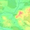
Coolcor topographic map

Click on the map to display elevation.

About this map

Name: Coolcor topographic map, elevation, terrain.

Location: Coolcor, Ballyburly ED, The Municipal District of Edenderry, County Offaly, Leinster, Ireland (53.35525 -7.24149 53.37201 -7.19257)

Average elevation: 81 m

Minimum elevation: 71 m

Maximum elevation: 131 m

Other topographic maps

Click on a map to view its topography, its elevation and its terrain.
Daingean

Ireland > County Offaly

Average elevation: 82 m

Cappincur

Ireland > County Offaly

Average elevation: 65 m

Banagher

Ireland > County Offaly > Banagher

Average elevation: 43 m

Charlestown

Ireland > County Offaly > Charlestown

Average elevation: 61 m

Rahan

Ireland > County Offaly

Average elevation: 53 m

Ballycommon

Ireland > County Offaly

Average elevation: 80 m

Rath

Ireland > County Offaly

Average elevation: 66 m

Durrow

Ireland > County Offaly

Average elevation: 66 m

Mount Lucas

Ireland > County Offaly

Average elevation: 76 m

Croghan

Ireland > County Offaly

Average elevation: 100 m

Rathvilla

Ireland > County Offaly

Average elevation: 72 m

Coolderry

Ireland > County Offaly

Average elevation: 107 m

Harbour

Ireland > County Offaly

Average elevation: 62 m

Rahan

Ireland > County Offaly

Average elevation: 53 m

Gear up for your next adventure:

🥾Waterproof Trail Shoes - Shoes designed to handle wet terrain
👟Leg Gaiters - Keep debris, mud, and snow out of your boots
⛺Camping Groundsheet - Protect your tent from moisture and dirt
⛺Camping Tent - Weather-resistant tents suitable for 2 to 6 people
🥾Trekking Boots - Durable boots for long-distance trekking

As an Amazon Associate, this site earns from qualifying purchases at no extra cost to you.