Geolocate

Veloor topographic map

Click on the map to display elevation.

About this map

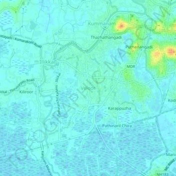
Name: Veloor topographic map, elevation, terrain.

Location: Veloor, Kottayam, Kerala, 686020, India (9.56217 76.47880 9.60217 76.51880)

Average elevation: 5 m

Minimum elevation: -4 m

Maximum elevation: 33 m

Other topographic maps

Click on a map to view its topography, its elevation and its terrain.

Sankranthi

India > Kerala > Kottayam > Kottayam

Average elevation: 15 m

Meenadom

India > Kerala > Kottayam > Pariyaram

Average elevation: 36 m

Manimala River

India > Kerala > Kottayam > Eravinalloor

Average elevation: 12 m

Kanjikuzhy

India > Kerala > Kottayam > Manganam

Average elevation: 14 m

Meenachil

India > Kerala > Kottayam > Pulikuttisseri

Average elevation: 7 m

Karapuzha

India > Kerala > Kottayam > Kottayam

Average elevation: 7 m

Alapuzha

India > Kerala > Kottayam > Kottayam

Average elevation: 10 m

child

India > Kerala > Kottayam > Thiruvanchoor

Average elevation: 13 m

Alapuzha

India > Kerala > Kottayam > Kottayam

Average elevation: 10 m

Alapuzha

India > Kerala > Kottayam > Kottayam

Average elevation: 10 m

Gear up for your next adventure:

💧Filtered Water Bottle - Safe drinking water on the go
🧳Compression Sacks - Maximize space in your backpack by shrinking gear
🧊Insulated Water Bottle - Keeps drinks cold in summer and prevents freezing in winter
🔨Vehicle Emergency Tool - Safety tool for remote road trips to trailheads
🕶️Polarized Sunglasses - Protect your eyes with durable polarized lenses

As an Amazon Associate, this site earns from qualifying purchases at no extra cost to you.