
Gattahalli topographic map
Click on the map to display elevation.
About this map
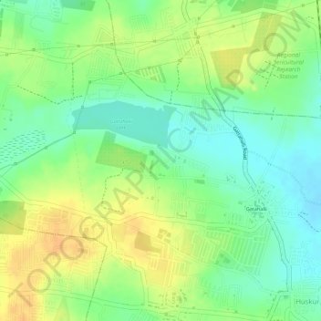
Name: Gattahalli topographic map, elevation, terrain.
Location: Gattahalli, Anekal, Bangalore Urban, Karnataka, India (12.86145 77.68626 12.88376 77.70565)
Average elevation: 905 m
Minimum elevation: 888 m
Maximum elevation: 921 m
Other topographic maps
Click on a map to view its topography, its elevation and its terrain.