Geolocate

Jaén topographic map

Click on the map to display elevation.

About this map

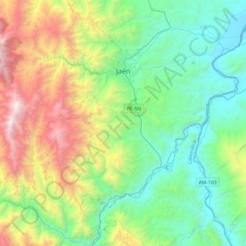
Name: Jaén topographic map, elevation, terrain.

Location: Jaén, Province of Jaén, Cajamarca, Peru (-5.94448 -78.97270 -5.61414 -78.71980)

Average elevation: 1,197 m

Minimum elevation: 386 m

Maximum elevation: 3,217 m

Other topographic maps

Click on a map to view its topography, its elevation and its terrain.

Montan

Peru > Cajamarca > Lajas

Average elevation: 2,483 m

Gear up for your next adventure:

🔭Compact Binoculars - Lightweight optics for scouting trails and wildlife
🧥Waterproof Hiking Jacket - Protect yourself from rain and wind while hiking
🥽Outdoor Goggles - Protective eyewear for outdoor activities
🥾Trail Running Shoes - Lightweight and durable shoes for trail running
🧴Insect Repellent - Protect yourself from bugs during outdoor adventures

As an Amazon Associate, this site earns from qualifying purchases at no extra cost to you.