Geolocate

Ballymartin topographic map

Click on the map to display elevation.

About this map

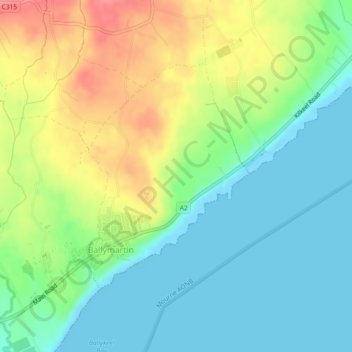
Name: Ballymartin topographic map, elevation, terrain.

Location: Ballymartin, County Down, Northern Ireland, United Kingdom (54.07781 -5.95343 54.09514 -5.93200)

Average elevation: 29 m

Minimum elevation: 0 m

Maximum elevation: 79 m

Gear up for your next adventure:

🎒Hiking Daypack - Lightweight and durable backpacks for day trips and excursions
🥾Lightweight Hiking Shoes - Comfortable shoes for day hikes
🔦UV Flashlight - Detect minerals or specific insects in the dark
🚲Bike Repair Kit - Essential tools for on-trail mechanical issues
🔦LED Flashlight - Powerful and long-lasting flashlight for camping and emergencies

As an Amazon Associate, this site earns from qualifying purchases at no extra cost to you.