Geolocate

Heckfield topographic map

Click on the map to display elevation.

About this map

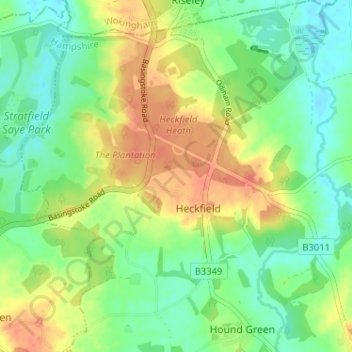
Name: Heckfield topographic map, elevation, terrain.

Location: Heckfield, Hart, Hampshire, England, United Kingdom (51.32388 -0.99470 51.36390 -0.93593)

Average elevation: 63 m

Minimum elevation: 44 m

Maximum elevation: 87 m

Gear up for your next adventure:

🔭Outdoor Binoculars - Lightweight binoculars for birdwatching and hiking
💧Hydration Bladder - Hands-free hydration solution for long treks
🥘Camping Cookware Set - Compact nesting pots and pans for trail cooking
🧥Ultralight Puffy Jacket - Maximum warmth that packs down to the size of an orange
🥾Lightweight Hiking Boots - Boots for comfort and mobility on long hikes

As an Amazon Associate, this site earns from qualifying purchases at no extra cost to you.