Geolocate

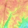
Merrifield topographic map

Click on the map to display elevation.

About this map

Name: Merrifield topographic map, elevation, terrain.

Location: Merrifield, Fairfax County, Virginia, United States (38.86493 -77.27438 38.88956 -77.21809)

Average elevation: 111 m

Minimum elevation: 81 m

Maximum elevation: 151 m

Other topographic maps

Click on a map to view its topography, its elevation and its terrain.
Gear up for your next adventure:

🥽Outdoor Goggles - Protective eyewear for outdoor activities
🚲Bike Repair Kit - Essential tools for on-trail mechanical issues
🧣Evaporative Cooling Towel - Beat the heat during intense summer climbs
🧰Emergency Multi-Tool - Compact multi-tool for outdoor survival
⛺Camping Essentials - All-in-one gear for a comfortable camping trip

As an Amazon Associate, this site earns from qualifying purchases at no extra cost to you.