Geolocate

Varberg topographic map

Click on the map to display elevation.

About this map

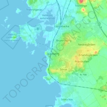
Name: Varberg topographic map, elevation, terrain.

Location: Varberg, Varbergs kommun, Halland County, 432 41, Sweden (57.06574 12.21029 57.14574 12.29029)

Average elevation: 8 m

Minimum elevation: -2 m

Maximum elevation: 66 m

Gear up for your next adventure:

🪑Ultralight Camping Stool - Compact seating for rest stops during long hikes
🛰️Satellite Messenger - Emergency communication for areas with no cell service
🔦LED Headlamp - Hands-free lighting for early morning starts or late finishes
🦶Hiking Shoe Insoles - Added support for high arches and long days on feet
🥫Freeze-Dried Meals - Lightweight, high-calorie nutrition for multi-day treks

As an Amazon Associate, this site earns from qualifying purchases at no extra cost to you.