Geolocate

Atlas topographic map

Click on the map to display elevation.

About this map

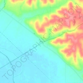
Name: Atlas topographic map, elevation, terrain.

Location: Atlas, Pike County, Illinois, 62370, United States (39.49394 -90.98958 39.53394 -90.94958)

Average elevation: 165 m

Minimum elevation: 133 m

Maximum elevation: 228 m

Other topographic maps

Click on a map to view its topography, its elevation and its terrain.

New Salem

United States > Illinois > Pike County

Average elevation: 235 m

Hull

United States > Illinois > Pike County

Average elevation: 142 m

Nebo

United States > Illinois > Pike County

Average elevation: 164 m

Barry

United States > Illinois > Pike County

Average elevation: 215 m

New Salem

United States > Illinois > Pike County

Average elevation: 235 m

Gear up for your next adventure:

🎒Hiking Daypack - Lightweight and durable backpacks for day trips and excursions
🥾Mountain Hiking Boots - High-traction boots for rocky terrain
🧰Emergency Multi-Tool - Compact multi-tool for outdoor survival
💧Hydration Pack - Hands-free hydration system for long hikes
🥫Freeze-Dried Meals - Lightweight, high-calorie nutrition for multi-day treks

As an Amazon Associate, this site earns from qualifying purchases at no extra cost to you.