Geolocate

Nellis topographic map

Click on the map to display elevation.

About this map

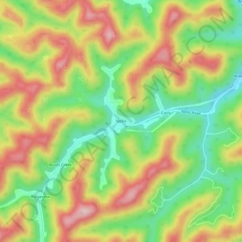
Name: Nellis topographic map, elevation, terrain.

Location: Nellis, Boone County, West Virginia, 25142, United States (38.13093 -81.76262 38.17093 -81.72262)

Average elevation: 328 m

Minimum elevation: 201 m

Maximum elevation: 465 m

Other topographic maps

Click on a map to view its topography, its elevation and its terrain.

Danville

United States > West Virginia > Boone County

Average elevation: 280 m

Gear up for your next adventure:

🧰Multitool Knife - Compact and versatile tool for outdoor use
🧤Thermal Hiking Gloves - Grip-enhanced gloves for cold-weather altitude trekking
💡Portable Camping Lamp - Rechargeable lamp for campsite lighting
🔋Emergency Crank Radio - Weather alerts and power without needing batteries
🥾Waterproof Hiking Boots - Essential footwear for rugged terrain and wet Canadian trails

As an Amazon Associate, this site earns from qualifying purchases at no extra cost to you.