Geolocate

Tambogrande topographic map

Click on the map to display elevation.

About this map

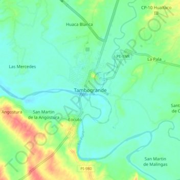
Name: Tambogrande topographic map, elevation, terrain.

Location: Tambogrande, Tambo Grande, Province of Piura, Piura, Peru (-4.97535 -80.38240 -4.89535 -80.30240)

Average elevation: 73 m

Minimum elevation: 55 m

Maximum elevation: 121 m

Gear up for your next adventure:

🍽️Titanium Camping Spork - Ultralight and indestructible eating utensil
🔭Compact Binoculars - Lightweight optics for scouting trails and wildlife
🧢Hiking Hat - Sun-protective and breathable hats for long treks
💡LED Headlamp - Hands-free illumination for night hiking and camping
👖Convertible Hiking Pants - Zip-off legs to adapt to changing weather conditions

As an Amazon Associate, this site earns from qualifying purchases at no extra cost to you.