
Riley Park topographic map
Click on the map to display elevation.
About this map
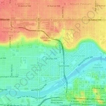
Name: Riley Park topographic map, elevation, terrain.
Location: Riley Park, Hillhurst, Calgary, Alberta, Canada (51.05757 -114.09158 51.05946 -114.08609)
Average elevation: 1,069 m
Minimum elevation: 1,041 m
Maximum elevation: 1,101 m
Alberta trails, hiking, mountain biking, running and outdoor activities
Other topographic maps
Click on a map to view its topography, its elevation and its terrain.