
Pendleton topographic map
Click on the map to display elevation.
About this map
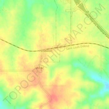
Name: Pendleton topographic map, elevation, terrain.
Location: Pendleton, Warren County, Missouri, United States (38.82445 -91.23679 38.84197 -91.22692)
Average elevation: 271 m
Minimum elevation: 246 m
Maximum elevation: 288 m
Other topographic maps
Click on a map to view its topography, its elevation and its terrain.
Little Lost Creek Conservation Area
United States > Missouri > Warren County > Pendleton
Average elevation: 241 m