Geolocate

Hesteberget topographic map

Click on the map to display elevation.

About this map

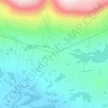
Name: Hesteberget topographic map, elevation, terrain.

Location: Hesteberget, Hol, Buskerud, 3593, Norway (60.52926 7.99702 60.54926 8.01702)

Average elevation: 1,345 m

Minimum elevation: 1,174 m

Maximum elevation: 1,809 m

Other topographic maps

Click on a map to view its topography, its elevation and its terrain.

Flå

Norway > Buskerud

Average elevation: 719 m

Hemsedal

Norway > Buskerud

Average elevation: 1,217 m

Kongsberg

Norway > Buskerud

Average elevation: 388 m

Hol

Norway > Buskerud

Average elevation: 1,204 m

Norefjell

Norway > Buskerud

Average elevation: 758 m

Hemsedal

Norway > Buskerud

Average elevation: 1,217 m

Ringerike

Norway > Buskerud

Average elevation: 443 m

Flesberg

Norway > Buskerud

Average elevation: 520 m

Ål

Norway > Buskerud

The Bergen Line, the rail line between Oslo and Bergen runs through Ål. Ål Station has an elevation of 436 meters (1,430 ft) and is the halfway station on the Bergen Line.

Average elevation: 1,023 m

Flesberg

Norway > Buskerud

Average elevation: 520 m

Hemsedal

Norway > Buskerud

Average elevation: 1,217 m

Hemsedal

Norway > Buskerud

Average elevation: 1,217 m

Hole

Norway > Buskerud

Average elevation: 266 m

Drammen

Norway > Buskerud

Average elevation: 209 m

Drammen

Norway > Buskerud

Average elevation: 209 m

Nesbyen

Norway > Buskerud

Average elevation: 842 m

Gear up for your next adventure:

🥾Trail Hiking Socks - Comfortable socks to prevent blisters and fatigue
🕯️Camping Lantern - Illuminates your entire campsite with high-efficiency LEDs
🧭GPS Handheld Device - Reliable GPS navigation for outdoor adventures
🧦Thermal Socks - Warm socks for winter hiking or camping
💡LED Camping Lantern - Illuminate your campsite with long-lasting lanterns

As an Amazon Associate, this site earns from qualifying purchases at no extra cost to you.