Geolocate

Hell topographic map

Click on the map to display elevation.

About this map
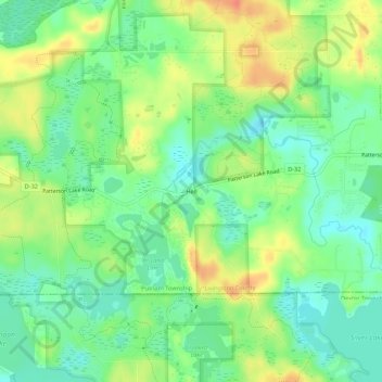
Name: Hell topographic map, elevation, terrain.

Location: Hell, Putnam Township, Livingston County, Michigan, United States (42.41476 -84.00495 42.45476 -83.96495)

Average elevation: 277 m

Minimum elevation: 257 m

Maximum elevation: 304 m

Other topographic maps

Click on a map to view its topography, its elevation and its terrain.

Howell

United States > Michigan > Livingston County

Average elevation: 282 m

Brighton

United States > Michigan > Livingston County

Average elevation: 287 m

Gear up for your next adventure:

🛶Canoe Life Vest - Safety vest for water sports
🚑Survival Whistle - Signal for help across long distances in mountains
🦶Hiking Shoe Insoles - Added support for high arches and long days on feet
🔦LED Headtorch - Bright and durable light for night activities
🥾Hiking Leggings - Comfortable leggings for outdoor activities

As an Amazon Associate, this site earns from qualifying purchases at no extra cost to you.