Geolocate

Hell topographic map

Click on the map to display elevation.

About this map

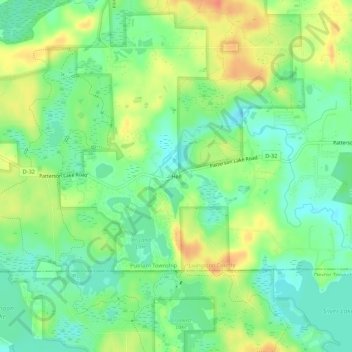
Name: Hell topographic map, elevation, terrain.

Location: Hell, Putnam Township, Livingston County, Michigan, United States (42.41476 -84.00495 42.45476 -83.96495)

Average elevation: 277 m

Minimum elevation: 257 m

Maximum elevation: 304 m

Other topographic maps

Click on a map to view its topography, its elevation and its terrain.

Howell

United States > Michigan > Livingston County

Average elevation: 282 m

Brighton

United States > Michigan > Livingston County

Average elevation: 287 m

Gear up for your next adventure:

🧊Insulated Water Bottle - Keeps drinks cold in summer and prevents freezing in winter
🥾Light Hiking Boots - Lightweight and comfortable boots for day hikes
🧴Sunscreen SPF - Broad-spectrum sunscreen for outdoor activities
🛌Insulated Sleeping Pad - Critical thermal barrier between you and the cold ground
🚲Bike Repair Kit - Essential tools for on-trail mechanical issues

As an Amazon Associate, this site earns from qualifying purchases at no extra cost to you.