Geolocate

Cushing topographic map

Click on the map to display elevation.

About this map

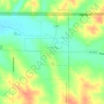
Name: Cushing topographic map, elevation, terrain.

Location: Cushing, Woodbury County, Iowa, United States (42.46099 -95.68458 42.46812 -95.66918)

Average elevation: 402 m

Minimum elevation: 379 m

Maximum elevation: 431 m

Other topographic maps

Click on a map to view its topography, its elevation and its terrain.

Sioux City

United States > Iowa > Woodbury County > Sioux City

Average elevation: 361 m

Gear up for your next adventure:

🧦Thermal Socks - Warm socks for winter hiking or camping
🧳Compression Sacks - Maximize space in your backpack by shrinking gear
💧Hydration Pack - Hands-free hydration system for long hikes
🧦Hiking Liner Socks - Thin base layer to prevent friction and blisters
🧣Merino Neck Gaiter - Protects against wind, sun, and cold at high altitudes

As an Amazon Associate, this site earns from qualifying purchases at no extra cost to you.