
Villers-Cernay topographic map
Interactive map
Click on the map to display elevation.
About this map
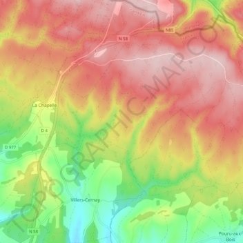
Name: Villers-Cernay topographic map, elevation, terrain.
Average elevation: 329 m
Minimum elevation: 194 m
Maximum elevation: 434 m
Other topographic maps
Click on a map to view its topography, its elevation and its terrain.
Rubécourt-et-Lamécourt
France > Grand Est > Ardennes > Bazeilles
Rubécourt-et-Lamécourt, Bazeilles, Sedan, Ardennes, Grand Est, France métropolitaine, 08140, France
Average elevation: 212 m
Le Bel Aune
France > Grand Est > Ardennes > Bazeilles
Le Bel Aune, Villers-Cernay, Bazeilles, Sedan, Ardennes, Grand Est, France métropolitaine, 08140, France
Average elevation: 395 m