Geolocate

Adam Peak topographic map

Click on the map to display elevation.

About this map

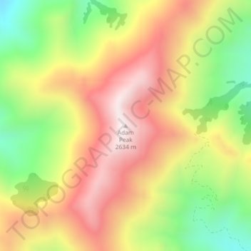
Name: Adam Peak topographic map, elevation, terrain.

Location: Adam Peak, Humboldt County, Nevada, United States (41.16041 -117.30517 41.16051 -117.30507)

Average elevation: 2,260 m

Minimum elevation: 1,855 m

Maximum elevation: 2,629 m

Other topographic maps

Click on a map to view its topography, its elevation and its terrain.

Winnemucca

United States > Nevada > Humboldt County

Average elevation: 1,365 m

Sonoma Valley

United States > Nevada > Humboldt County

Average elevation: 2,052 m

Winnemucca

United States > Nevada > Humboldt County

Average elevation: 1,365 m

Winnemucca

United States > Nevada > Humboldt County

Average elevation: 1,365 m

Winnemucca

United States > Nevada > Humboldt County

Average elevation: 1,365 m

Sonoma Valley

United States > Nevada > Humboldt County

Average elevation: 2,052 m

Gear up for your next adventure:

🕶️Polarized Sunglasses - Protect your eyes with durable polarized lenses
🥾Mountaineering Boots - Supportive boots for climbing and high-altitude hiking
Camping Tent - Weather-resistant tents suitable for 2 to 6 people
🥾Mountain Hiking Shoes - Shoes with superior grip for mountainous terrain
🚲Handlebar Phone Mount - View topographic-map.com live while cycling

As an Amazon Associate, this site earns from qualifying purchases at no extra cost to you.