Geolocate

Shedfield topographic map

Click on the map to display elevation.

About this map

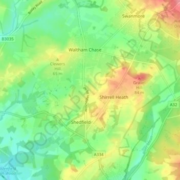
Name: Shedfield topographic map, elevation, terrain.

Location: Shedfield, Winchester, Hampshire, England, United Kingdom (50.90466 -1.24432 50.94411 -1.16873)

Average elevation: 43 m

Minimum elevation: 9 m

Maximum elevation: 96 m

Gear up for your next adventure:

🥤Collapsible Travel Cup - Saves space and weight in your mess kit
🛶Kayak Accessories - Essential gear for safe and fun kayaking adventures
🧦Merino Wool Socks - Moisture-wicking comfort for long-distance hiking
🧰Emergency Multi-Tool - Compact multi-tool for outdoor survival
🧭GPS Tracker - Track your location in remote areas safely

As an Amazon Associate, this site earns from qualifying purchases at no extra cost to you.