
Jaintia Hills topographic map
Interactive map
Click on the map to display elevation.
About this map
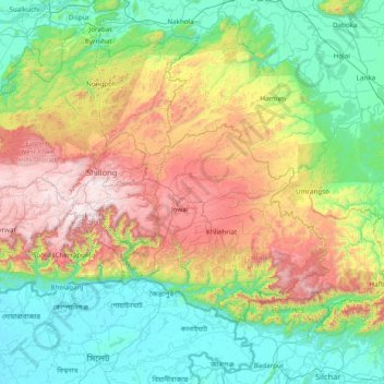
Name: Jaintia Hills topographic map, elevation, terrain.
Location: Jaintia Hills, West Jaintia Hills District, Meghalaya, Inde (24.80000 91.55000 26.20000 92.95000)
Average elevation: 534 m
Minimum elevation: 4 m
Maximum elevation: 1,948 m
Other topographic maps
Click on a map to view its topography, its elevation and its terrain.