Geolocate

Winthrop topographic map

Click on the map to display elevation.

About this map
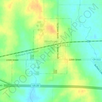
Name: Winthrop topographic map, elevation, terrain.

Location: Winthrop, Buchanan County, Iowa, United States (42.46210 -91.75631 42.47935 -91.72697)

Average elevation: 315 m

Minimum elevation: 301 m

Maximum elevation: 332 m

Gear up for your next adventure:

🥾Mountain Trail Shoes - High-traction shoes for mountain trails
🦶Hiking Shoe Insoles - Added support for high arches and long days on feet
🧥Thermal Fleece Jacket - Versatile insulation for changing mountain temperatures
🧢Sun Protection Cap - Breathable cap to protect from sun exposure
🧥Waterproof Jacket - Lightweight rain jackets for hiking and outdoor activities

As an Amazon Associate, this site earns from qualifying purchases at no extra cost to you.