Geolocate

Huxham topographic map

Click on the map to display elevation.

About this map

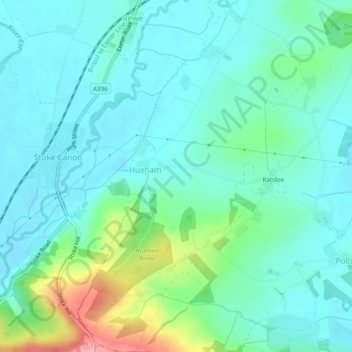
Name: Huxham topographic map, elevation, terrain.

Location: Huxham, East Devon, Devon, England, United Kingdom (50.75428 -3.50484 50.78473 -3.47388)

Average elevation: 42 m

Minimum elevation: 16 m

Maximum elevation: 134 m

Gear up for your next adventure:

🧴Sunscreen SPF - Broad-spectrum sunscreen for outdoor activities
🥾Approach Boots - Comfortable boots for hiking and climbing approaches
🌬️Windproof Camp Stove - Efficient cooking even on exposed mountain peaks
🥾Hiking Leggings - Comfortable leggings for outdoor activities
🔦UV Flashlight - Detect minerals or specific insects in the dark

As an Amazon Associate, this site earns from qualifying purchases at no extra cost to you.