Geolocate

Libungan topographic map

Click on the map to display elevation.

About this map

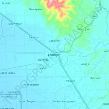
Name: Libungan topographic map, elevation, terrain.

Location: Libungan, North Cotabato, Soccsksargen, Philippines (7.20170 124.47755 7.28170 124.55755)

Average elevation: 39 m

Minimum elevation: 9 m

Maximum elevation: 343 m

Other topographic maps

Click on a map to view its topography, its elevation and its terrain.

Lake Jordan

Philippines > North Cotabato > Makilala

Average elevation: 2,383 m

President Roxas

Philippines > North Cotabato

Average elevation: 364 m

Gear up for your next adventure:

🥤Collapsible Travel Cup - Saves space and weight in your mess kit
🧥Thermal Layer - Insulating layer for cold outdoor conditions
🧼Biodegradable Camp Soap - Environmentally friendly cleaning for gear and body
🥽Outdoor Goggles - Protective eyewear for outdoor activities
🧭GPS Tracker - Track your location in remote areas safely

As an Amazon Associate, this site earns from qualifying purchases at no extra cost to you.