Geolocate

Sector 24 topographic map

Click on the map to display elevation.

About this map

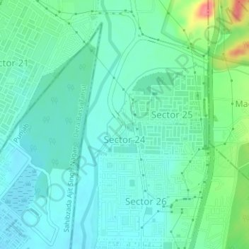
Name: Sector 24 topographic map, elevation, terrain.

Location: Sector 24, Panchkula, Haryana, India (30.66626 76.87619 30.67319 76.88105)

Average elevation: 327 m

Minimum elevation: 309 m

Maximum elevation: 385 m

Other topographic maps

Click on a map to view its topography, its elevation and its terrain.

Panchkula

India > Haryana > Panchkula

Average elevation: 347 m

Chauki nadah

India > Haryana > Panchkula

Average elevation: 435 m

Panchkula

India > Haryana > Panchkula

Average elevation: 347 m

Gear up for your next adventure:

🥾Mountain Hiking Shoes - Shoes with superior grip for mountainous terrain
🥤Collapsible Travel Cup - Saves space and weight in your mess kit
🥾Lightweight Hiking Boots - Boots for comfort and mobility on long hikes
🥾Trekking Boots - Durable boots for long-distance trekking
🛌Insulated Sleeping Pad - Critical thermal barrier between you and the cold ground

As an Amazon Associate, this site earns from qualifying purchases at no extra cost to you.