
Redvale topographic map
Click on the map to display elevation.
About this map
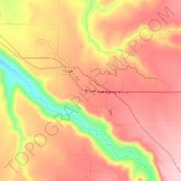
Name: Redvale topographic map, elevation, terrain.
Location: Redvale, Montrose County, Colorado, 81431, United States (38.15499 -108.43731 38.19499 -108.39731)
Average elevation: 1,949 m
Minimum elevation: 1,797 m
Maximum elevation: 2,024 m
Other topographic maps
Click on a map to view its topography, its elevation and its terrain.
Black Canyon of the Gunnison National Park
United States > Colorado > Montrose County
Average elevation: 2,225 m
Black Canyon of the Gunnison Wilderness
United States > Colorado > Montrose County
Average elevation: 2,163 m
Black Canyon of the Gunnison National Park
United States > Colorado > Montrose County
Average elevation: 2,225 m