Geolocate

Kennard topographic map

Click on the map to display elevation.

About this map

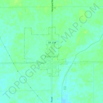
Name: Kennard topographic map, elevation, terrain.

Location: Kennard, Henry County, Indiana, 47351, United States (39.89872 -85.52875 39.91160 -85.51382)

Average elevation: 318 m

Minimum elevation: 312 m

Maximum elevation: 323 m

Other topographic maps

Click on a map to view its topography, its elevation and its terrain.

Hillsboro

United States > Indiana > Henry County

Average elevation: 326 m

Greensboro

United States > Indiana > Henry County

Average elevation: 304 m

Millville

United States > Indiana > Henry County

Average elevation: 347 m

New Lisbon

United States > Indiana > Henry County

Average elevation: 332 m

Gear up for your next adventure:

🧥Insulated Jacket - Keep warm in cold outdoor conditions
🧭Orienteering Kit - Tools for map reading and navigation in the wild
🏃Hydration Running Vest - Carry water and maps close to your body for speed
🧭GPS Tracker - Track your location in remote areas safely
🧴Sunscreen SPF - Broad-spectrum sunscreen for outdoor activities

As an Amazon Associate, this site earns from qualifying purchases at no extra cost to you.